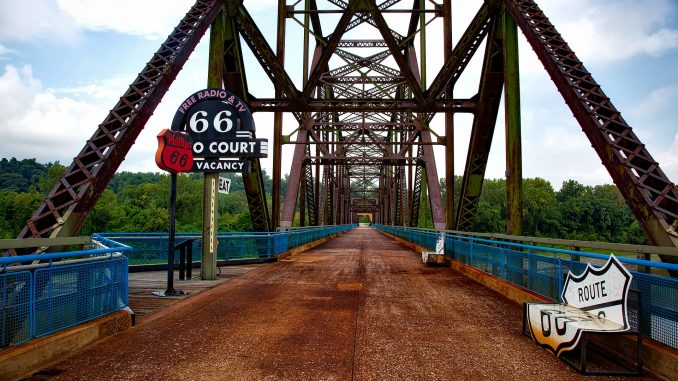
The Chain of Rocks Bridge, sometimes called the Old Chain of Rocks Bridge is a 5,353 feet (1,632 m) long pedestrian bridge most notable for its 22-degree bend roughly in the middle of the crossing. Originally the Chain of Rocks Bridge was a motor route used as a section of U.S. Route 66 to cross the Mississippi River, but it is now only open to pedestrian traffic. The Chain of Rocks Bridge spans the Mississippi River on the north edge of St Louis, Missouri. The eastern end of the bridge rests in Madison, Illinois, and the western edge on the Missouri shoreline.
The bridge gets its fitting name from a large shoal called the Chain of Rocks that make this small section of the Mississippi River notoriously difficult and dangerous to navigate. It’s because of this small dangerous section of the river that the bend in the bridge was designed. The bend was something of a compromise due to unique geography and concerns about river navigation around the rocks and the bridges pylons. Today, the Chain of Rocks is visible only during extreme low water conditions thanks to some serious dam construction completed by the Corp of Engineers in the late 1960’s.
Construction of the Chain of Rocks Bridge started on both sides of the river simultaneously in 1927, and the support piers were completed by August of 1928. The originally plans was for a New Year’s Day celebration to officially open the bridge in 1929, but floods and ice in the winter stalled the work. The bridge was finally opened to traffic more than a half a year late in July of 1929.
The two gothic-like castles standing in the river just to the south of the bridge are intakes for the Chain of Rocks Water Purification Plant. The water treatment facility has been operating since 1894 and is largely responsible for mitigating the impact of the typhoid and cholera epidemic that plagued St Louis in 1903 that claimed 287 lives.
Visiting the Chain of Rocks Bridge.
Anyone wanting to travel the length of the historic Route 66 needs to take a little time out of their trip to walk the length of the Chain of Rocks Bridge. It takes you back to a time when auto travel was something very different than it is today. It is however important to note that the bridge is sometimes closed due to inclement weather, or at the whim of local police departments because of nearby vandalism.
If it is open and you want to walk the bridge, it is best to do it during the week and early in the morning. On the weekends it can get a little crowded, and when there are few people there you really get a sense of how isolated it is. It’s also a good idea to take a camera and binoculars if you have them since there are sometimes bald eagles (especially when it’s a bit cold) nearby. It’s not just the wildlife that is worth having a camera near at hand. There are some truly amazing views of the St. Louis skyline and the Mississippi River visible from the bridge.
There is parking nearby, but like in any situation it’s not wise to leave valuables in your car unattended.
Chain of Rocks Bridge Facts
- Parking is available at the start of the pedestrian route.
- Financing for the Chain of Rocks Bridge was entirely by tolls.
- At 5,353 feet (1,632 m), the Chain of Rocks Bridge is the longest pedestrian bridge.
- In 1998, the bridge was leased to Trailnet, a local trails group. They are largely responsible for it being accessible to foot traffic today.
- Vehicle traffic has since 1968 been moved to the New Chain of Rocks Bridge.
- The bridge officially opened to all traffic in July of 1929.
- After the bridge was closed to auto traffic and before it was re-opened to foot traffic, it was featured in the 1981 movie Escape from New York as the 69th Street Bridge.
- Escape from New York had a budget of $6 million and grossed $25.2 million at the box office.
- The Chain of Rocks Bridge was added to the National Register of Historic Places in 2006


