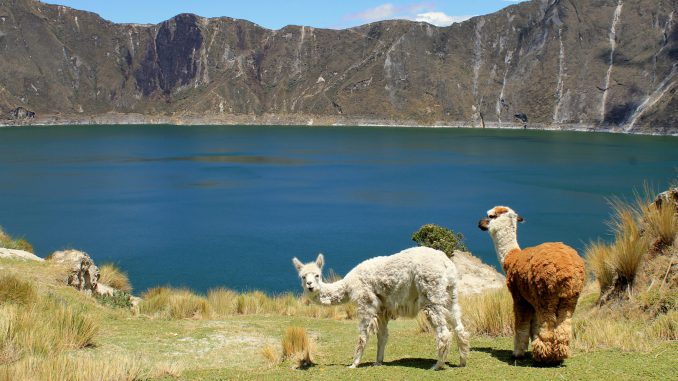
The water-filled caldera and westernmost volcano in the Ecuadorian Andes Quilotoa hasn’t erupted in over 800 years and has turned into one of the most beautiful hiking spots in all of Ecuador. After a dormant period of 14,000 years, Quilotoa erupted and left a crater which is now filled with greenish, mineral rich water 820ft deep.
Growing in popularity as an eco-tourist site there are more and more people taking the route to the summit each year. Most often the 17km trip from Zumbahua (the nearest town) is made in a bus or hired car, but there is an increasing number of people hiking the multi-day trail making up the Quilotoa Traverse. With many hikes and trails around the caldera, there are an increasing number services in the area offering mules, guides, and hostels.
While the amenities are limited and the hiking can be tough especially in the rain, Quilotoa is well worth the trip if you are in good physical shape. There are plenty of llamas (which are adorable) and the views will make you wish you had more time to spend taking in the natural beauty.
Quilotoa Facts
- The lip of the caldera is over 3km in diameter and has an irregular shape.
- The highest elevations are over 3800km and the SE peak which is the tallest is 3915m.
- While camping is permitted in the crater there is no potable water and it must be hiked in.
- Visitors will be required to pay a small fee to take in the view from the lip of the caldera (usually 3-5 USD).
- The 280m hike out of the caldera averages 1-2 hours.
- There are limited restrooms in the area so be prepared to rough it.
- The total volume of water stored in Lake Quilotoa is 0.35 km3.
- The water is receding very slowly and the level has decreased over 10m since 2000.


